
Route characteristics
Difficulty scale
GDX
5
Mountain value
G
0
Class group

Ultra
Mountain value group
G
Flat
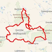
Distance
⨦ 251 km
Flat equivalent
Uphill
+ 1 000 m
Downhill
- 1 000 m
Location
Zabór, Polska
Time predictions
Check your potential! Estimate your finish time, see if you can ride the course in a certain time, or maybe you'll compete for the win?
Check nowRoute information
Elevation data
GPX data
Number of events with this course
1
Event date
6 Sep 2025
Results published
18 May 2026
Valuation status
Results during the 2025 edition


Women

Course statistics
Join to discover more!
Check your race history, analyze your achievements, and compare results with other cyclists.
Log in nowCourse variant code V-240 - records for a course in this event are grouped by this code.

Your effort has a color
Amator
Beginner Level
Advanced Level
Expert Level
Elite
Graveling App © 2018 / 2026
GDX Gravel Ranking